Updated 7/3/25
 |
RollerCon Interactive Google Map This interactive map shows all the convention spaces, including host hotel(s) and nearby Urgent Care Clinics and Hospital medical facilities, pharmacies, groceries, skate parks and more. Scroll in super tight to see convention space details. Click on items in the map key on the left to be taken directly to that location on the map. Scroll out to see RollerCon in the context of the entire planet. Get directions and more. Save this link: http://tinyurl.com/rollerconmap |
 click for small file |
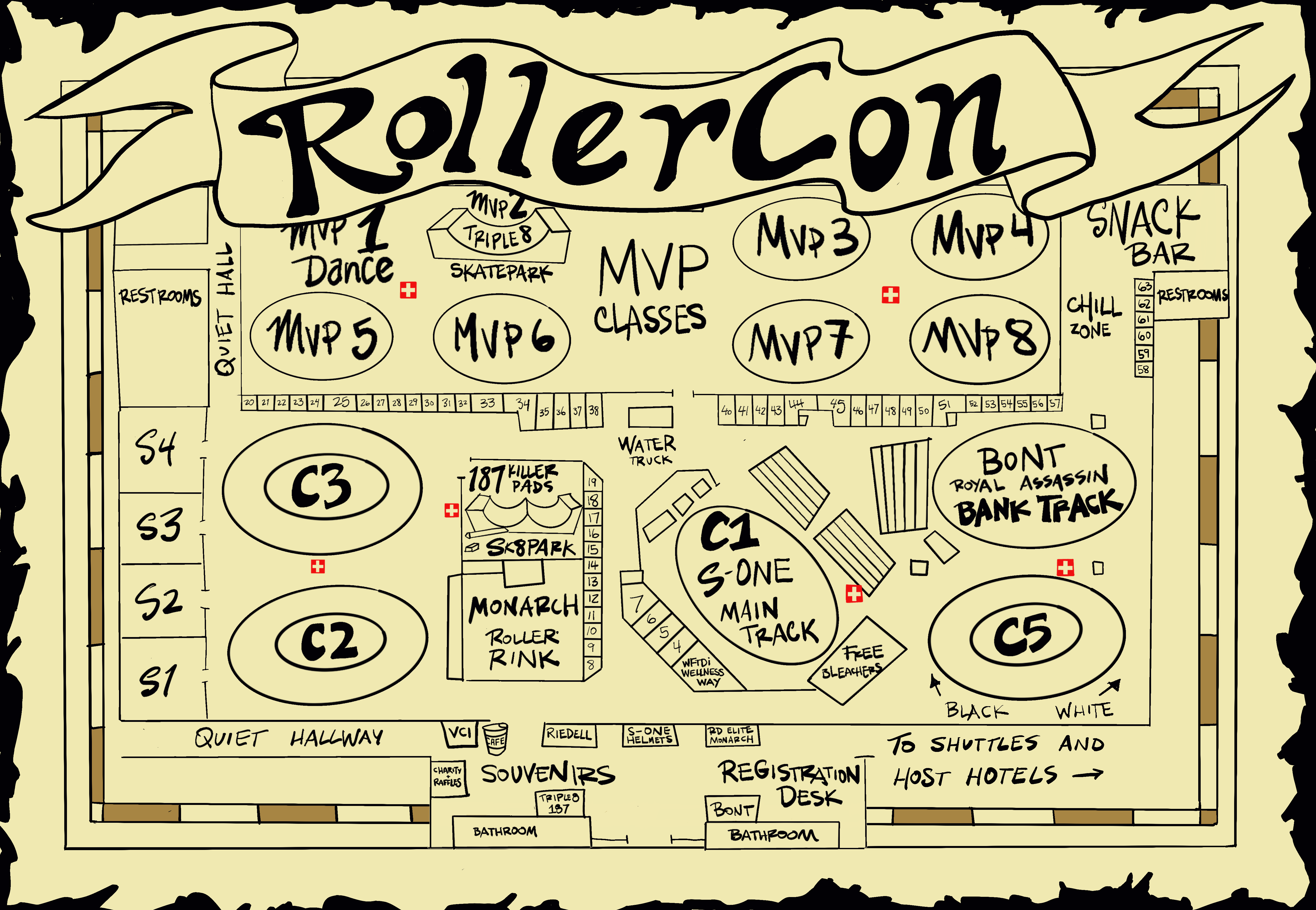
The RollerCon Map (larger file) shows the convention spaces (including tracks, vendor areas and more) inside the Expo at World Market Center. This map also lives in the RollerCon app! This map is subject to change until you’re actually standing in it, but we try to keep the most recent versions here and in the app. Check for updates. |
Transportation options:
- The RollerCon Shuttles
- RTC Transit Buses – Past RollerCon attendees reported good experiences with Las Vegas city transit.
- Taxi service – They’re everywhere. Just look for a “taxi stand” sign, hail one off the street or ask the guy in the funny outfit in any hotel entryway where they pick up.
- This page was made before rideshare apps. Yep.
Maps:
These were created some time ago, so check the info before you travel.
- Strip Map (all casinos)
- Skate Parks (also in the interactive map)
- YELP link to closest grocery stores: http://tinyurl.com/rc-groceries (or you can just look at the interactive map, which also lists nearby groceries)